File:CRHA-map.jpg
Jump to navigation
Jump to search
Size of this preview: 800 × 516 pixels. Other resolution: 1,578 × 1,017 pixels.
Original file (1,578 × 1,017 pixels, file size: 456 KB, MIME type: image/jpeg)
Summary
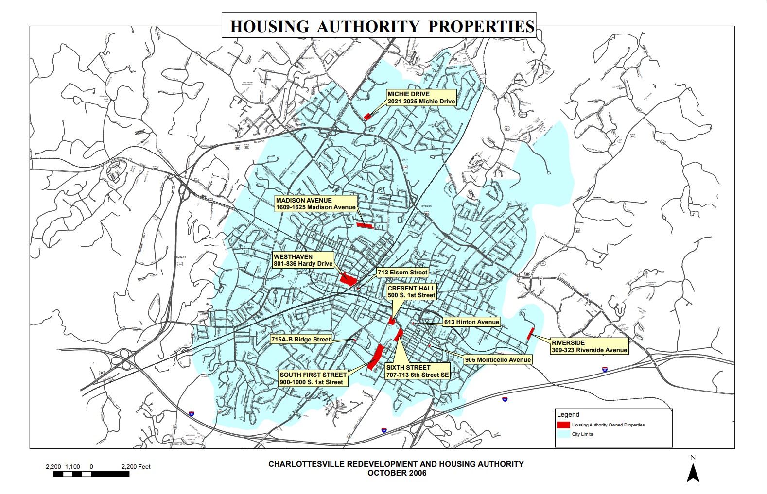
A map showing locations of public housing sites owned and operated by the Charlottesville Redevelopment and Housing Authority. Downloaded from the CRHA website on August 27, 2019.
File history
Click on a date/time to view the file as it appeared at that time.
| Date/Time | Thumbnail | Dimensions | User | Comment | |
|---|---|---|---|---|---|
| current | 11:09, 27 August 2019 | | 1,578 × 1,017 (456 KB) | Seantubbs (talk | contribs) | A map showing locations of public housing sites owned and operated by the Charlottesville Redevelopment and Housing Authority. Downloaded from the CRHA website on August 27, 2019. |
You cannot overwrite this file.
File usage
The following page uses this file: